{NOTA 2021: Último mapa actualizo en el siguiente post }
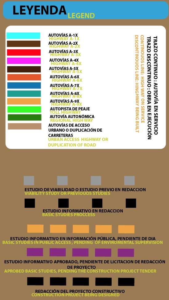
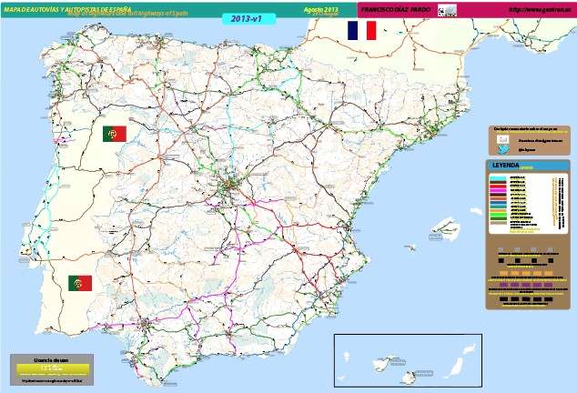
Hemos decidido actualizar el Mapa de Autovías y Autopistas de España a fecha de diciembre 2013, con todas las actualizaciones en cuanto a estudios, proyectos y obras. En la siguiente leyenda se explica el diferente tipo de lineas del mapa.
We have just update the Highway and Toll Highway of Spain up to 2013 december, with all the updatings within the studies, projects, or works. In the next legend you can check any type of line in this map.

Recordar que este mapa es web, y requiere el uso del botón derecho para hacer zoom y el izquierdo para moverse por ese nivel de zoom. Para acceder al mapa, pulsar sobre la imagen siguiente
We should say that this map is a web version, and require the use of right button to make zoom and left one to move around this zoom level. Acessing the map is so simple as click at the next image:

Disponemos de una versión de mapa para dispositivos IOS, para un mapa hecho en HTML5, que sea accesible desde Iphone o Ipad. Para navegar por él simplemente usar el zoom de dedos de estos dispositivos, tras pulsar la siguiente imagen:
We’ve also added a map accesible for ios devices ( iphone ipad ), within html5 structure. To access it only click over the next image and use the finger-zoom of these devices:

Francisco Díaz Pardo
Autor de Geotren
Ingeniero en Telecomunicaciones (Universidad de Sevilla)
Máster en Sistemas Ferroviarios (Universdad Pontificia de Comillas-ICAI)
Docente del Sistema Público de Educación en la Comunidad de Madrid
